
On the bright side, skunk mating season is just a sign that spring is just around the corner though. In fact, it is less than 35 days away. Although from the weather we had over the past weekend, it seems spring may be arriving early. Believe it or not, we have had just as many days with 60-plus degree temperatures since winter started as we’ve had with days of more than a trace of snowfall. That is amazing.
February is usually the snowiest month which is why the full moon that occurs during this time is called the “snow moon”. But this year, we are running well below average on our annual snowfall by almost 9 inches.
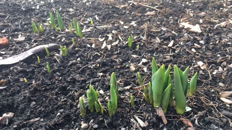
I’ve also seen many viewer pictures sent in across the Miami Valley of Mother Nature being a bit confused with numerous spring flowers coming up and blooms on some trees. While Tuesday’s weather is expected to be cool, it is certainly not some of the best “snuggle weather” we’ve gotten on past Valentine’s Days. You’ve got to go back 2007 for our last decent Valentine’s Day snow storm in the Miami Valley.
If the long-range models are accurate, it will likely be very difficult for us to get close to making up the deficit before the clock on winter runs out. Temperatures will likely climb back into the 60s next weekend with the month likely ending well above normal. It is also possible that the warmer pattern will likely trigger an early beginning of severe weather season which is something we will be watching for very closely. We’ve already had some close calls from severe storms which have mainly impacted areas just to our south and west.
It is also unclear how the fading of the La Nina weather pattern could influence our weather as we head toward spring. A La Niña pattern is characterized by unusually cold ocean waters in the equatorial region of the Pacific Ocean. El Niño is characterized by unusually warm ocean temperatures in this area. These ocean temperatures influence jet stream and weather patterns across North America. It is important to note the last time we had a weak La Nina such as we had this past winter was the winter of 2011-2012. The following spring and summer were exceedingly hot with a very active severe weather season that lasted through July. February of 2012 was very similar to how this month is panning out so we’ll have to see if history repeats.
Eric Elwell is WHIO StormCenter 7 Chief Meteorologist. Contact him at eric.elwell@coxinc.com or follow him on Facebook and Twitter.
About the Author